The Ultimate Geosteering Software for High-Speed Drilling
Land and Stay in Zone with Confidence – Faster, More Accurate Geosteering
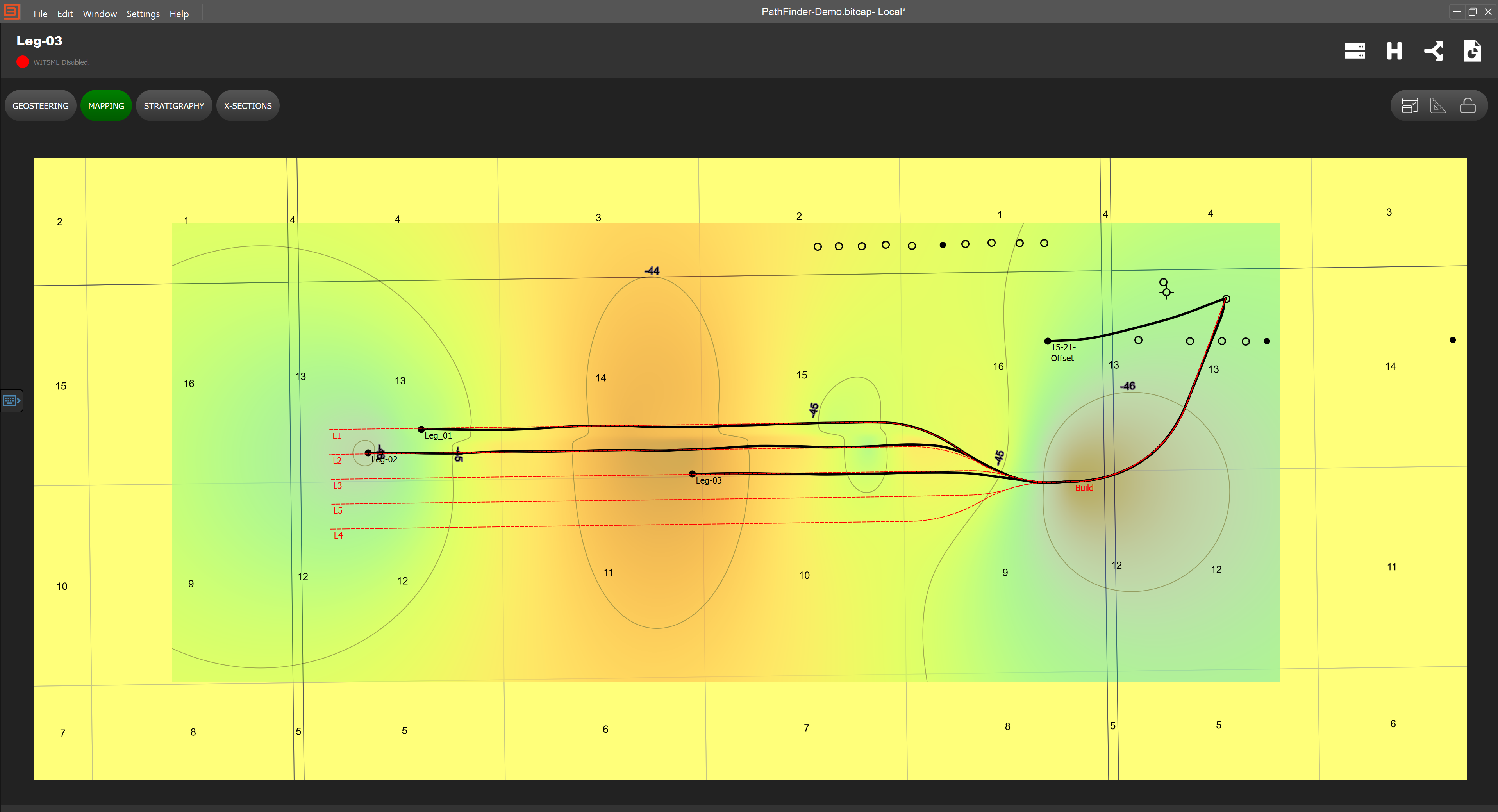
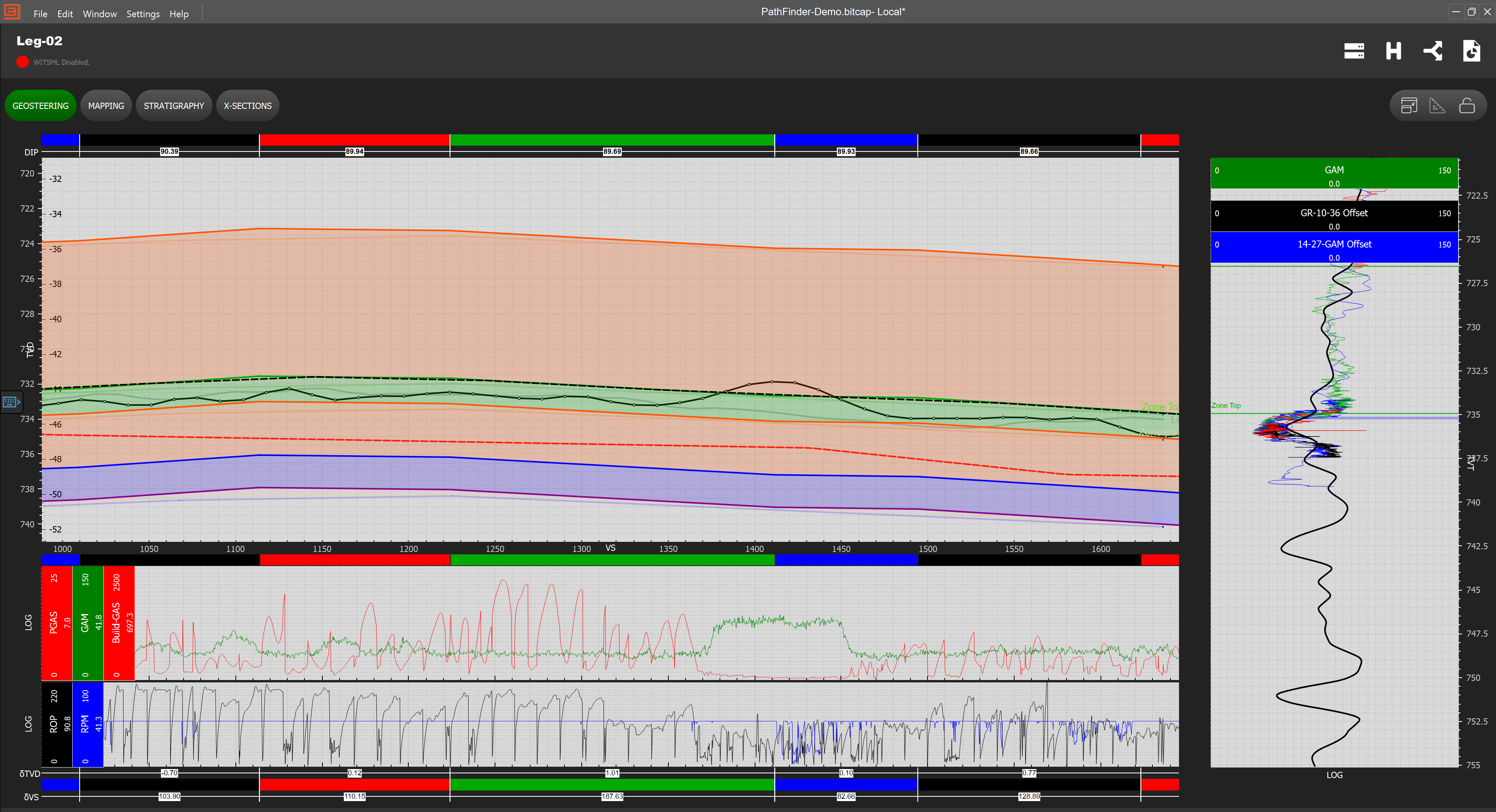
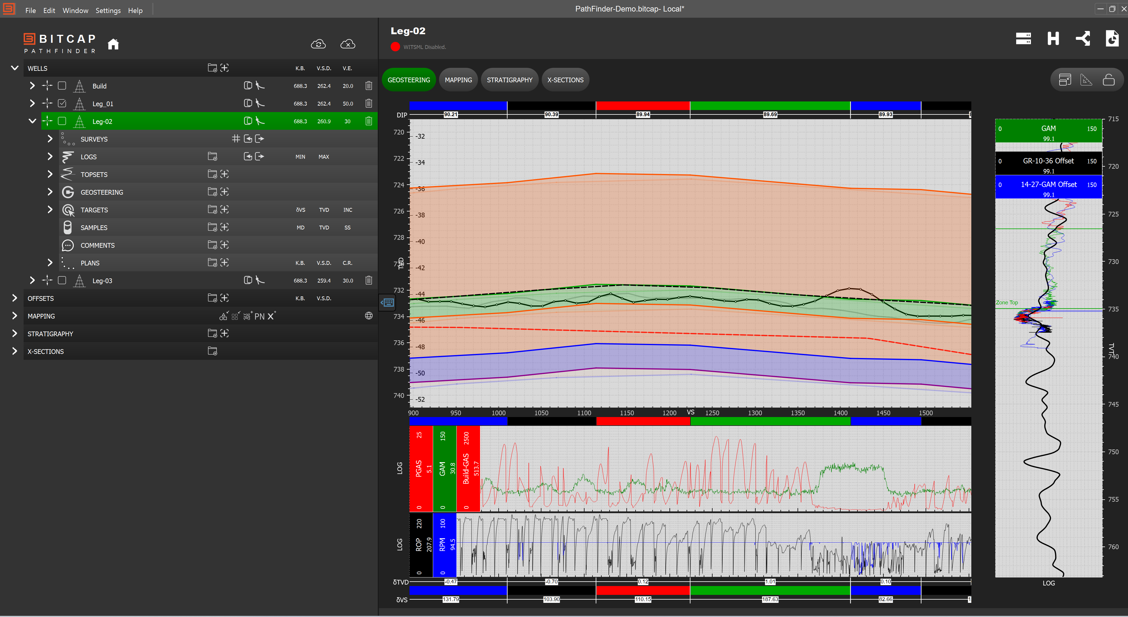
In today’s fast-paced drilling environment, geologists need more than just data—they need real-time insights that drive precision and efficiency. PathFinder is a next-generation geosteering software designed to optimize well placement, enhance decision-making, and streamline subsurface visualization.
Why Choose PathFinder for Geosteering?
Unlike conventional geosteering tools, PathFinder was built with high-speed drilling and modern workflows in mind. It eliminates inefficiencies by integrating multiple data sources into a single, intuitive platform, enabling geologists to steer with confidence and accuracy.
Faster Decision-Making – Real-time Data Streaming and Plotting.
All-in-One View – Geosteering, sample photos, descriptions, and reports — all connected.
Built for High-Speed Drilling – Handles rapid drilling environments with accuracy.
Cloud & Offline Access – Work and collaborate anytime, anywhere.
User-Centric Design – Intuitive workflows designed by geologists, for geologists.
🍪 This website uses cookies to improve your web experience.